From Sportfishing
Fish Report for 10-2-2018

BLM Emergency Stabilization Projects on Public Lands Burned in Carr Fire
10-2-2018
BLM
The Bureau of Land Management is beginning work on emergency stabilization projects aimed at reducing post fire damage and threats to public safety on public lands burned in the Carr Fire.
Natural resource specialists in the Redding Field Office are working from an Emergency Stabilization and Rehabilitation plan prepared by a team of specialists called a Burned Area Emergency Response Team. The ES&R plan calls for work to protect watersheds that will be vulnerable to excessive runoff during winter storms, removal of trees at risk of falling, replacement of bridges and culverts on recreation trails, fencing and blocking exposed mine shafts and protecting cultural and historic resources sites.
The BAER team determined that cleaning and replacing culverts critical for carrying storm runoff under roads is a high priority, because blocked culverts can lead to road washouts. Crews will immediately begin working on those projects along BLM roads and trails. Additionally, the plan calls for patrols and culvert cleaning during storms.
Crews will continue felling fire-weakened trees along approximately 150 miles of BLM’s recreational trail network, along roads, and in forested areas, an important task to protect public safety, Mata said. While emergency stabilization efforts do not include salvage logging, the BLM is beginning the process of identifying commercial timber opportunities in the burned area.
Workers will replace burned bridges and trail signs, and smooth trail tread that was damaged during fire suppression. Workers will continue work already underway to clear blocked routes.
“A unique challenge along our trail network will be providing safety measures to keep visitors out of the 20 vertical and horizontal mine shafts that were exposed when vegetation was burned away,” said Jennifer Mata manager of the BLM Redding Field Office. “In the short term we will fence and sign these hazards. In the long term we will permanently block or seal these features to prevent access.”
Mata said that the fire also stripped away vegetation that hid cultural and historical resource sites from view, increasing the likelihood of looting.
“We are assessing the conditions of these sites and will increase law enforcement patrols to safeguard these resources that are protected by federal law,” she said. “We also will complete projects to stabilize sites at risk from erosion damage or landslides.”
Natural resource specialists will also monitor approximately 8,000 acres of burned public land for encroachment of invasive weeds. The ES&R plan calls for early detection and eradication of these infestations and monitoring results.
“This is important work because invasive weeds displace native plants important in maintaining a diverse and healthy wildlife population,” Mata noted. “We will also be replanting native species in some burned areas, and hope to provide opportunities for volunteers to help out.”
“We have analyzed the potential environmental impacts of these projects, and preparing a categorical exclusion under the National Environmental Policy Act,” Mata added. “A categorical exclusion means the projects will have no significant adverse impact on the quality of the human environment.”
Mata said these environmental analyses are available at the BLM’s ePlanning website.
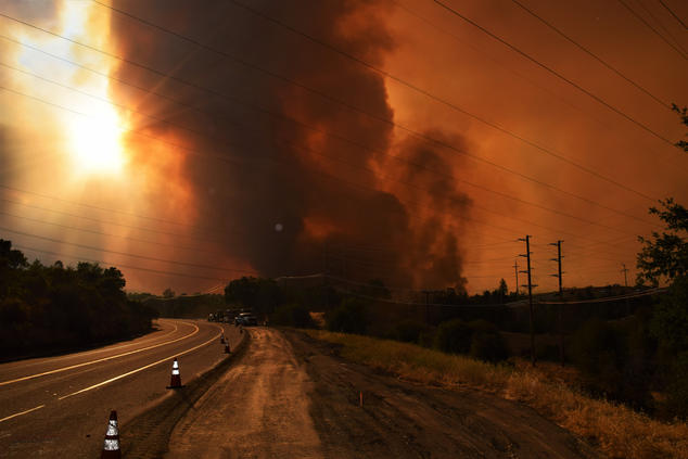
The Carr Fire was unprecedented in Shasta County, burning 229,651 acres, including 63,847 acres of BLM-managed public lands.
< Previous Report Next Report >

Website Hosting and Design provided by TECK.net

