Long Range Fish Report
From Sportfishing
From Sportfishing
Fish Report for 2-10-2011

North/South or East/West, Southern California fishing is the best
2-10-2011
Rich Holland
Perspectives on the Southern California coast
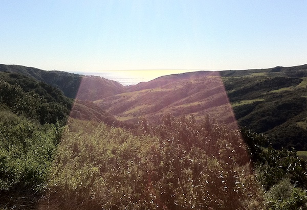
Decided to cut across through Malibu Canyon on the way back from visiting the Fred Hall gang in Camarillo this morning and the reward was an absolutely stunning view of Catalina Island across shimmering Santa Monica Bay waters riffled by the Santa Ana winds.
Now getting a glimpse of Catalina is something most of us take for granted, but this time was different because from that certain canyon you are presented with a full broadside view of the island. Catalina runs from east to west lengthwise like all the Channel Islands of any size, and even the small roundish ones have points and reefs that extend in the same directions.
It just that it takes a certain perspective to really understand and feel that orientation.
Aliso Woods Canyons Wilderness Park is close to my home and I'll go in there to hike and dodge mountain bikers for exercise and escape and at the top of a ridge looking down Laguna Canyon you get a similar kind of view of San Clemente Island -- at least on one those same Santa Ana wind days, since the island is 60 miles away.
Along the Ventura and Santa Barbara county coast it's like the islands are in your lap and you feel your headed north/south on 101, but come over the pass from Lake Cachuma and for a brief second before you wind left you get that broadside view.
What really separates the northern Channel Islands from the southern pair is the fact the weather can shoot the gap between San Miguel Island and Point Conception and the northern or front (facing the coast) sides of Miguel, Santa Rosa, Santa Cruz and Anacapa are often the "weather" sides, as opposed to the calm lee found most of the time on the front of Catalina and Clemente, where the backside of the islands get the most weather. A really nasty Santa Ana howling offshore makes the frontside of all the islands the weather side and there are stories of boats that set out on a calm, sunny day getting trapped overnight and even days by the devil drought winds.
The truly uncomfortable fact for fishermen is the east/west orientation of all the islands sometimes means the wind and waves split the difference and plow down either side. Then spots like Becher's and Pyramid cove are heaven and there has to be a topographical correlation between those kinds of spots and the great fishing found there.
The islands act as a giant breakwall that allows the swells and winds only to bend its way through and around the gaps in the coast. This results in those lovely "holes" in the ocean that even the big boats drop into at times. On a skiff it can feel like the rope on the elevator broke.
The chart room in the Newport Harbor Yacht Club offers the best graphic overall view. An entire wall contains the Southern California Bight with north at the top of the wall and Point Conception to the left and La Jolla to the right. It's amazing how much island and water fits in between.
Buzzing down the highway in your car at 75 mph it's easy for SoCal to feel small. Out on the water it's a much different perspective. And it's amazing how much bigger an island feels when you go into fish tight for seabass or calicos as opposed to cruising outside the kelp lines.
It's all how you look at it.
PHOTO
SAN CLEMENTE ISLANDlooks like a thin black line on the horizon in this view down Laguna Canyon with a wide angle lens.
Rich Holland's Roundup
< Previous Report Next Report >
More Reports
2-9-2011
MEXICAN BAJA COAST TRIP (020511)!!! I arrived at Seaforth Landing in San Diego last Friday at 4:30 p.m. I met...... Read More

2-8-2011
Join SFR and Fish Trap Lures on Qualifier 105 skiff tripQualifier 105 Sportfishing is the newest sponsor of SportfishingReport.com. SFR...... Read More

LongRangeSportfishing.net © 2024. All Rights Reserved.
Website Hosting and Design provided by TECK.net
Website Hosting and Design provided by TECK.net